Share on FacebookShare on TwitterShare on LinkedinEmail this link
About this project
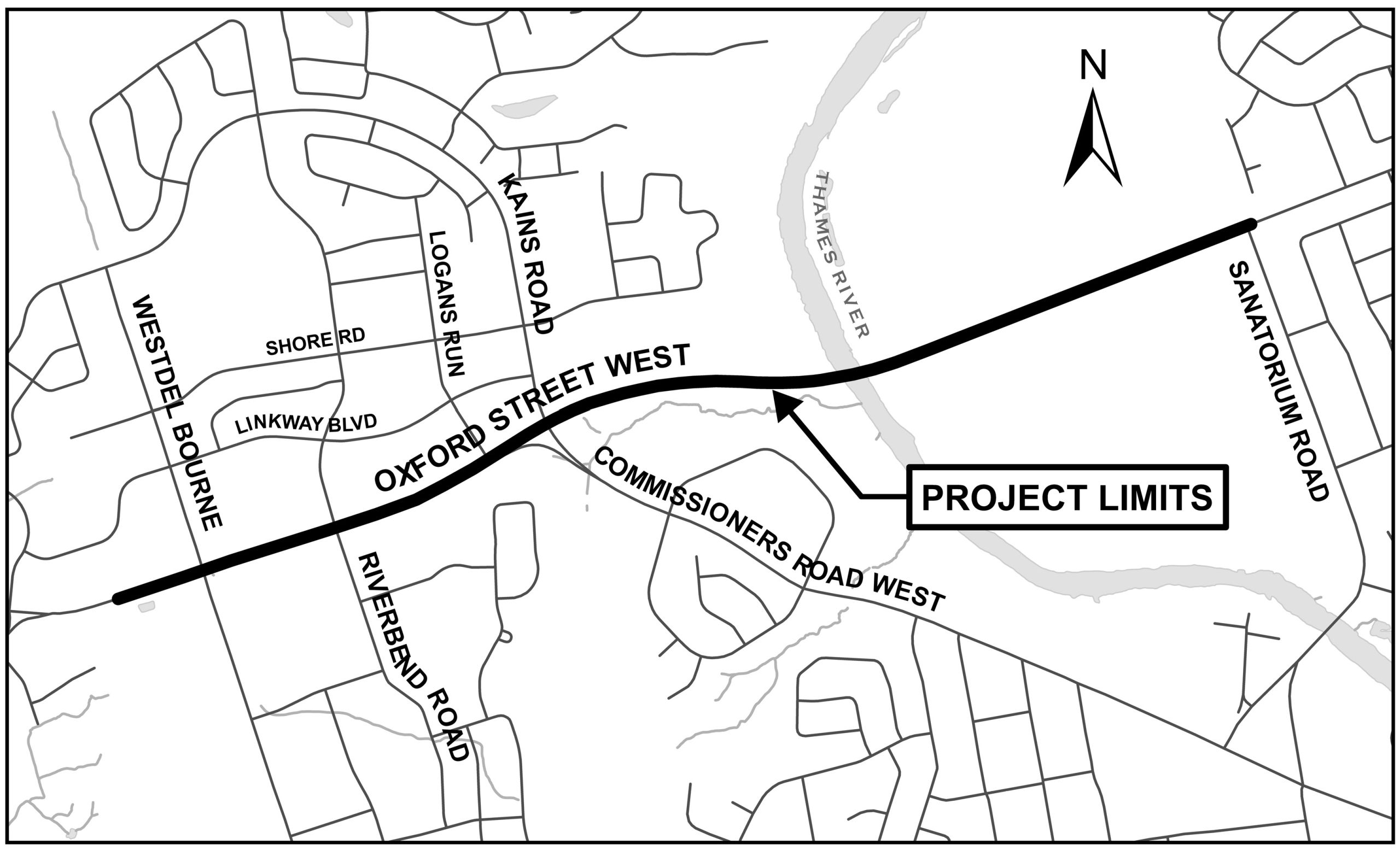
The City of London has initiated a Municipal Class Environmental Assessment (Class EA) study for improvements to Oxford Street West, from Westdel Bourne to Sanatorium Road.
This study builds on the City’s 2030 Transportation Master Plan and Cycling Master Plan to develop and review options to widen Oxford Street West from two to four lanes, improve intersection operations including consideration of roundabouts, and improve pedestrian and cycling facilities through the corridor. The potential need to widen the Thames River Bridge will also be reviewed.
In identifying improvements, the study will consider socio-economic, cultural heritage and natural environment factors as well as technical requirements and aesthetics.
Study area
Above: A map of the study area.The area includes Oxford Street West between Westdel Bourne to Sanatorium Road.
Public Information Centre #1
The first Public Information Centre was held on April 5, 2023, at 6:00 p.m.
The project team shared a presentation about the problems and opportunities in the study area, the existing conditions, the alternative solutions, and the study's next steps. The presentation is followed by a question-and-answer session with the project team.
Please note that all correspondence will be maintained for reference throughout the project and will become part of the project record. Under the Municipal Freedom of Information and Protection of Privacy Act (MFIPPA) and the Environmental Assessment Act (EAA), unless otherwise stated in the submission, any personal information such as name, address, telephone number and property location included in a submission will become part of the public record files for this project and will be released, if requested, to any person.
The personal information submitted on this page is collected under the authority of the Municipal Act, 2001, S.O. 2001, c. 25 and will be used to provide updates and details regarding future Oxford Street West Environmental Assessment supported communications, events, or activities.
Questions about this collection should be addressed to Erik Guil, Technologist II, 300 Dufferin Ave., London, ON N6A 4L9, or by telephone at 519-661-2489 ext. 5467, or email to eguil@london.ca
Thank you for your contribution!
Help us reach out to more people in the community
Share this with family and friends