The City of London is planning construction work on Boler Road this year to install a new two-way cycle track on the east side of Boler Road and to replace the aging watermain that is approaching its expected lifecycle.
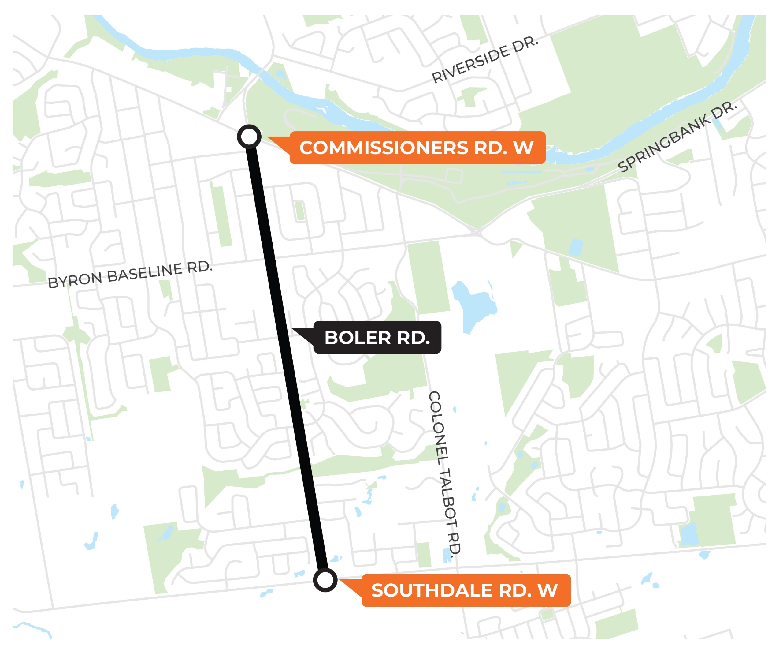
Above: The map above identifies the approximate limits of the construction project area. Work is planned on Boler Road from Commissioners Road to Southdale Road.
If you require any special accommodation in accessing the project information or online material, please contact the City project manager listed below, and we will work together to best share the information with you.
- Add a two-way separated cycling facility on the east boulevard, between Commissioners and Southdale.
- Replace watermain and water services between Byron Baseline and Griffith.
- Add new pedestrian crossings and intersection improvements.
- Reduce traffic speeds through narrowed roads and strategic medians.
- All vehicle lanes and turning lanes will be maintained.
- Replacing portions of the asphalt roadway.
- One new crossing at Optimist Park/ Manhattan.
- One new crossing at Norman (near Metro).
- One relocated crossing at Wayne (to align with sidewalks).
- Construction is planned to start in June or July 2026 and end in July 2027.
- A full closure between Byron Baseline and Griffith is required for watermain replacement, with detours in place. This work is planned to take 15–20 weeks. Local access only.
- Other phases will maintain traffic with some lane disruptions (eg. turn lanes at intersections).
- Advance notice signs will be displayed before construction starts.
- Mailout to Boler Rd residents two weeks before construction starts, with a more detailed schedule.
- Access is maintained to all properties.
- Traffic calming to be implemented on Griffith Street, on both sides of Boler Road, in a mix of Temporary and Permanent.
- Full traffic signal rebuild with accessibility upgrades at Boler/ Griffith.
- Signal modifications at Boler/ Commissioners and Boler/ Byron Baseline to accommodate the cycling lane.
- Protected left turns added for southbound traffic at all 3 intersections
- Drivers can only turn during the advanced left phase to improve safety
- Drivers can only turn during the advanced left phase to improve safety
- 211 trees assessed within the corridor.
- 62 small trees and 21 large trees are required to be removed.
- 77 trees to be replanted within the Boler Road corridor.
- Each year, the City plants ~5,000 trees total.
The City of London hosted a public update meeting on Wednesday, March 25, 2026, to provide an update on the project and share information on construction.


